Ömnögovi (Өмнөговь)· Хэрмэн цав
Khermen Tsav
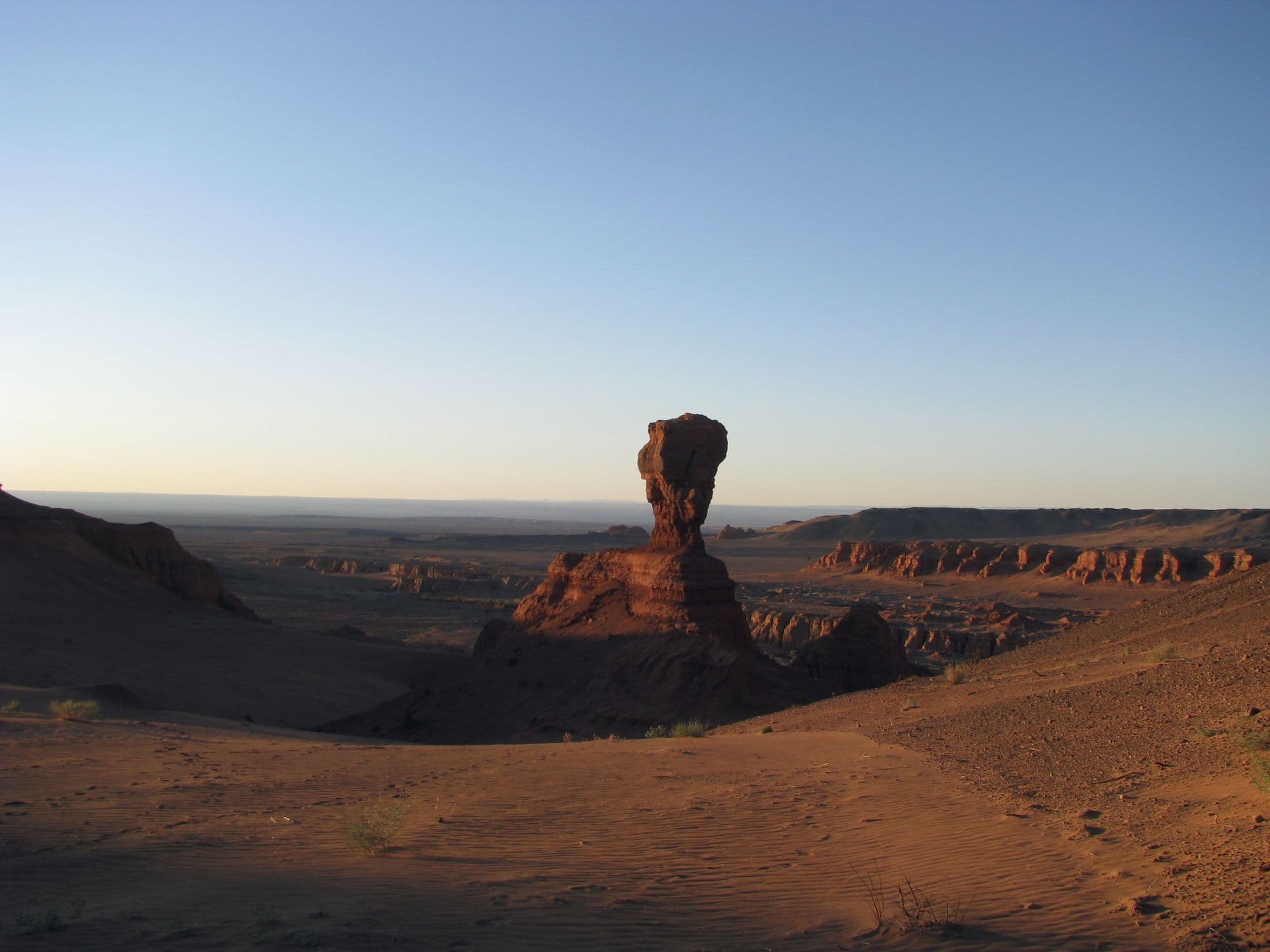
Khermen Tsav is a deep red canyon system cut into the far western Gobi, a maze of eroded sandstone walls, towers and spurs that Russian-speaking visitors nicknamed the Mongolian sphinxes. It is one of the richest Late Cretaceous fossil localities anywhere, the reference area for the Hermiin Tsav beds of the Barun Goyot Formation, and the sandstone preserves an ancient landscape that was itself a dune field. Almost nobody gets here: it is hundreds of kilometres of desert track from the nearest paved road, with no settlement, no fuel and no mobile signal. That remoteness is exactly why serious photographers and expedition travellers make the effort.
- From Ulaanbaatar
- 1,029 km
- Drive time
- About 20 hours of driving, realistically 2-3 days each way
- Altitude
- 1,001 m
- Typical stay
- 2 nights at the canyon, inside a trip that needs 4-6 days of driving around them
- Best months
- May–Jun, Sep
- Jan: not a best month
- Feb: not a best month
- Mar: not a best month
- Apr: not a best month
- May: a best month
- Jun: a best month
- Jul: not a best month
- Aug: not a best month
- Sep: a best month
- Oct: not a best month
- Nov: not a best month
- Dec: not a best month
Highlights
- The main canyon rim, where the red walls drop away with no barrier and no one else in sight
- Walking the canyon floor among free-standing towers and eroded spurs
- The formations known locally as sphinxes on the western side
- Fossil-bearing badlands that produced Bagaceratops, Saichania, Tarchia and Conchoraptor
- Saxaul stands and desert vegetation on the canyon floor
- Sunrise and sunset, when the sandstone goes from orange to blood red
- Some of the darkest night skies in Mongolia
- Total silence - the most common thing visitors remember
Season notes
Late May to June and September are the sensible windows. July and August are dangerously hot in a canyon with no shade and no water, and vehicle breakdowns in that heat are a serious problem this far from help. Spring sandstorms can make the track impassable. Nothing operates here in winter and the tracks are not maintained.
From Ulaanbaatar
Paved highway only as far as Dalanzadgad. Everything after that is desert track - several hundred kilometres of gravel, washboard and soft sand west via Gurvantes, with long stretches that are navigated by GPS and local knowledge rather than a defined road. Two vehicles, spare fuel, spare tyres and water are standard practice.
By air
None. Dalanzadgad (DLZ) is the nearest scheduled airport and is still several hundred kilometres of track away; charter flights to Gurvantes are occasionally arranged by expedition operators.
Where to stay
- No ger camps at the canyon. Visits are by tented camp brought in with the vehicles
- Basic guesthouse accommodation exists at Gurvantes sum centre, roughly 77 km east; rates are not published online
- Nomad family gers in the wider Gurvantes area may host travellers: roughly USD 20-40 per person per night including meals (2026)
Be aware
Sources (5)
- Barun Goyot Formation - Wikipedia — Hermiin Tsav as a locality, the Maastrichtian age, the aeolian dune palaeoenvironment and the full list of dinosaurs, birds and other fossils recovered there
- OpenStreetMap - Khermen Tsav viewpoint and sphinx formations — Canyon coordinates, the Gurvantes sum location, the sphinx nickname and the approach track from Gurvantes
- OpenStreetMap Nominatim - Gurvantes — Position of the Gurvantes sum centre used to calculate the distance to the canyon
- OpenTopoData SRTM 30 m elevation dataset — Canyon-floor elevation
- Ömnögovi - Wikivoyage — Private driver being effectively the only way to travel in the province, at a driver's fee of USD 50-75 per day plus food and lodging
Often combined with
Khongoryn Els (the Singing Dunes)
Ömnögovi · 838 km
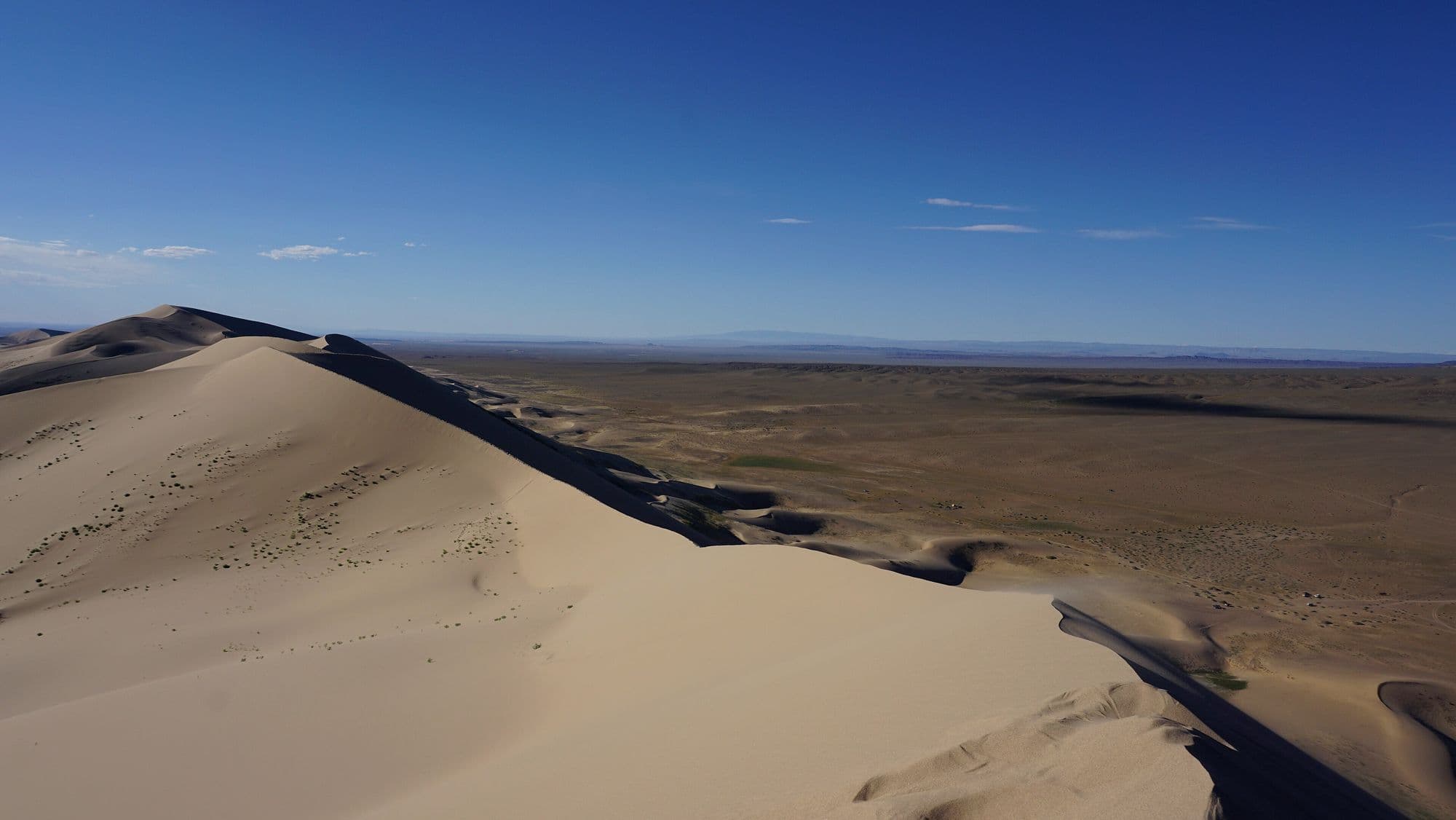
Khongoryn Els is the largest dune field in Mongolia, a band of sand running along the back of the Sevrei and Zöölön ranges with crests that rise as much as 300 m above the plain. Its nickname comes from the low droning hum the sand makes as grains slide and rub against each other on a windy day. The contrast is what makes it: bare rock mountains to the south, a wall of sand in the middle, and on the north side a green ribbon of oasis where the Khongoryn Gol stream surfaces and nomad families graze camels. Climbing the high dune for sunset is the standard reason people come, and it is much harder work than it looks.
- Best months
- Jun–Sep
Bayanzag (the Flaming Cliffs)
Ömnögovi · 667 km
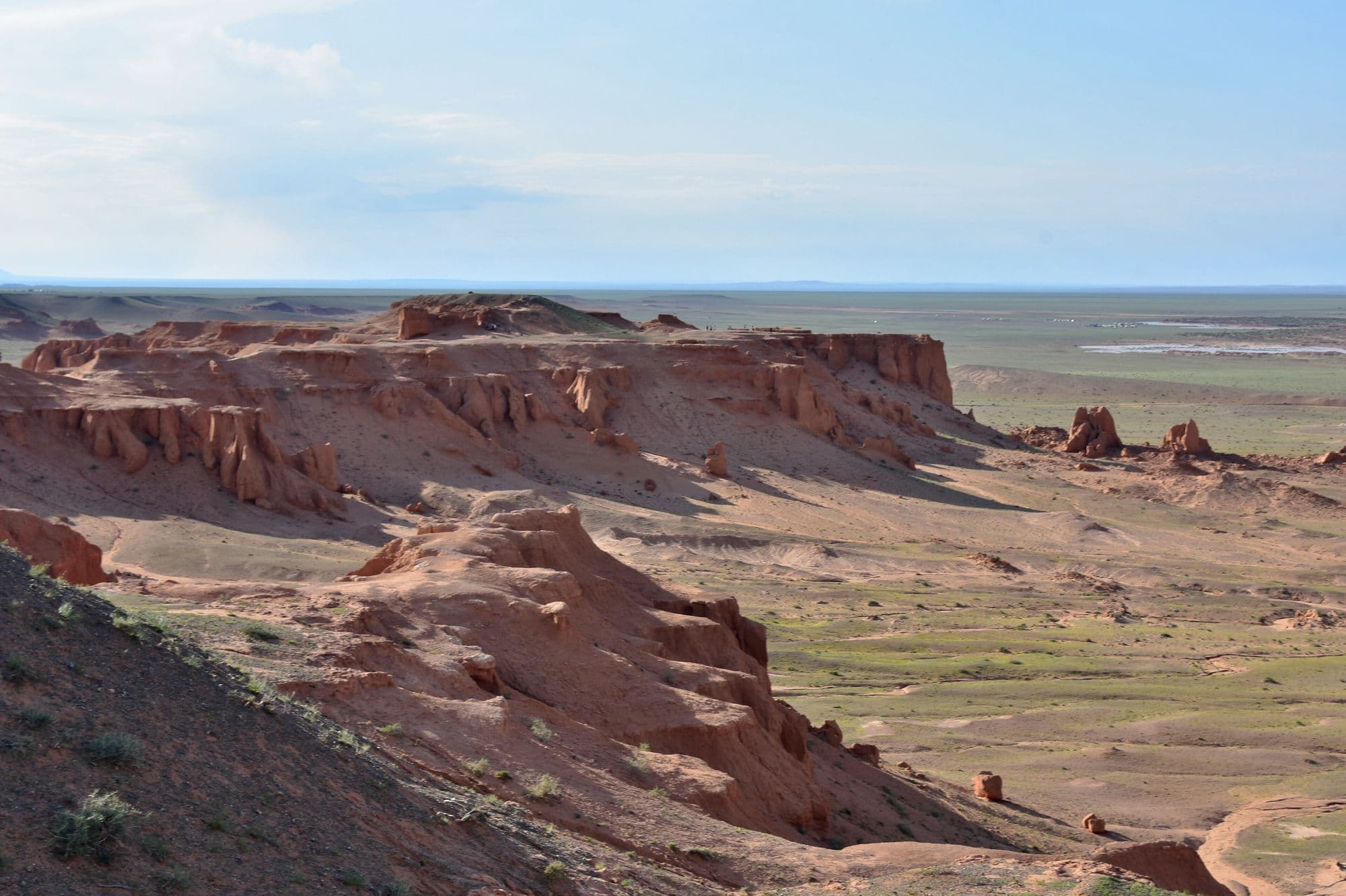
Bayanzag is a line of orange sandstone cliffs and badlands on the edge of a saxaul woodland, and it is the single most important site in the history of dinosaur palaeontology in Asia. Roy Chapman Andrews of the American Museum of Natural History named it the Flaming Cliffs in the 1920s for the colour the rock turns at sunset, and it was here that the first scientifically recognised dinosaur eggs were found. The rock belongs to the Djadochta Formation, which has also produced Velociraptor, Protoceratops, Oviraptor and some of the earliest known placental mammals. Visiting means walking the rim and the gullies below, which is a short and easy stop, and it is almost always timed for late afternoon.
- Best months
- May–Sep
Yolyn Am (Vulture's Gorge, often 'Eagle Valley')
Ömnögovi · 624 km
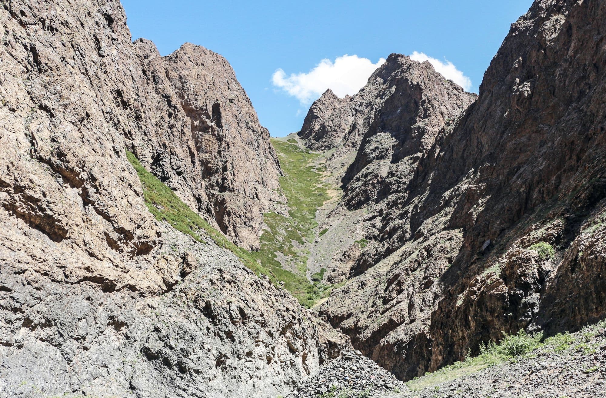
Yolyn Am is a narrow gorge cut into the Zuun Saikhan range inside Gobi Gurvansaikhan National Park, and it is the one place in the South Gobi where the desert stops feeling like desert. The walls close to a few metres apart, a stream runs along the floor, and for much of the year a sheet of ice sits in the shaded narrows. It is named after the yol, the bearded vulture that nests on the cliffs above. Visitors park at the mouth, pass a small natural history museum, and walk or ride a horse a few kilometres up the valley to the ice.
- Best months
- May–Sep